Open-Pit Mining Triggers Subsidence Up to 20 Km, a Danger Signal for Indonesia's Mining Regions
Baca dalam 60 detik
- Studi terbaru mengungkap penambangan terbuka batubara di Jerman barat memicu amblesan tanah hingga radius 20 kilometer dari tepi pit, jauh melampaui perkiraan sebelumnya.
- Penyebab utamanya adalah ekstraksi air tanah masif yang menurunkan muka air tanah, memicu reaktivasi sesar geologi dorman dan memperparah kerusakan bangunan serta infrastruktur.
- Temuan ini mendesak pemerintah daerah dan pelaku industri tambang di Indonesia untuk mengadopsi pemetaan risiko amblesan berbasis satelit guna melindungi permukiman dan infrastruktur kritis.
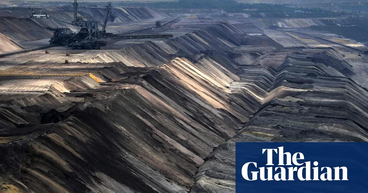
Open-pit mining does not only alter the landscape around the excavation pit, but also triggers land subsidence whose effects reach tens of kilometers from the mine site. A study of an open-pit coal mine in western Germany found that mining activity caused widespread ground lowering and reactivated previously inactive geological faults.
Research conducted by researchers from the GFZ Helmholtz Centre for Geosciences in Potsdam, Germany, analyzed satellite data and field geological measurements around the Rhenish coalfields, between Aachen and Cologne. The results, published in the journal Engineering Geology, show that the large volume of groundwater extracted to maintain mine operational safety lowered the water table, triggering subsidence up to 20 kilometers from the mine edge.
Of concern, the subsidence locations are not randomly distributed. Ground lowering tends to cluster and worsen along pre-existing geological faults, which were reactivated by mining-induced subsidence. The real impact is visible in cracks in buildings and roads in the surrounding area, including a school that shifted by as much as half a meter.
The study highlights an important difference between underground mines and open-pit mines. So far, land subsidence has more often been associated with underground mines, while the risks in open-pit mines have received less attention. In fact, the large groundwater demand for open-pit mining operations can trigger a similar domino effect, even wider in scope.
"The combination of satellite monitoring and geological data can be used to produce regional subsidence hazard maps, helping communities plan more resilient infrastructure," the researchers said in the report.
For Indonesia, these findings are a serious warning. Several regions in Kalimantan and Sumatra have large-scale open-pit coal mines operating close to settlements, national roads, and public facilities. Groundwater extraction for mining needs could potentially trigger subsidence in areas wider than previously anticipated. The vulnerability is worsened by Indonesia's geological conditions, which lie in an active fault zone.
Local governments and mining companies need to immediately adopt satellite monitoring technology to map subsidence risk periodically. Without mitigation measures, communities around mines face a long-term threat to safety and property. Environmental regulations also need to take into account the cumulative impact of groundwater extraction, not just the direct impact within the concession area.
Going forward, the question is no longer whether subsidence will occur, but how quickly risk mapping and subsidence-resistant infrastructure can be realized before casualties mount. The German experience shows that mining is still ongoing and subsidence is predicted to continue for decades—a warning that the impact of open-pit mining lasts far longer than its operational life.