El Niño Strengthens, Atlantic Storms Vanish: What Does It Mean for Indonesia?
Baca dalam 60 detik
- Fenomena El Niño yang menguat telah menekan aktivitas badai di Atlantik, dengan nol badai hingga pertengahan September 2026, memecahkan rekor sebelumnya.
- Pergeseran pola cuaca ini mengalihkan energi ke Pasifik timur, yang sudah dilanda tujuh badai, sementara para ilmuwan memperingatkan potensi badai yang lebih kuat di kemudian hari.
- Bagi Indonesia, El Niño biasanya membawa musim kemarau lebih kering dan risiko karhutla, sehingga pemerintah perlu memperkuat mitigasi bencana hidrometeorologi.
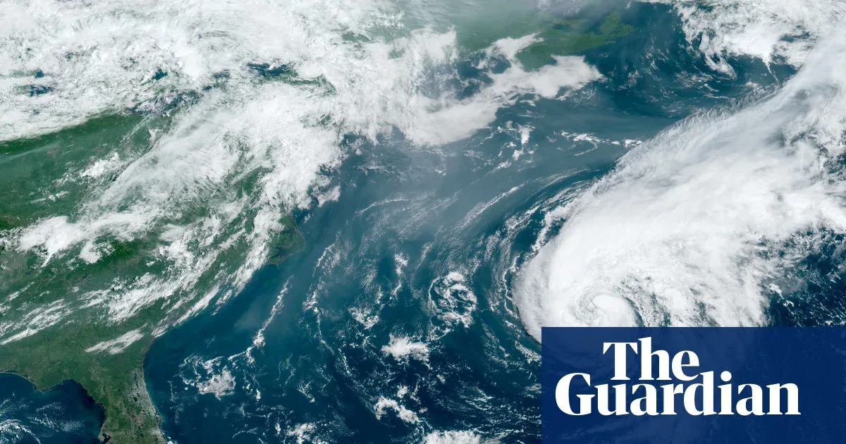
A strengthening El Niño has produced an unexpected effect: storms in the Atlantic have barely appeared. As of mid-September 2026, not a single tropical storm had formed in the Atlantic basin, breaking the previous record for the quietest season in recent decades. The National Oceanic and Atmospheric Administration (NOAA) even predicted a calm season with only two to six storms, far below the average of seven storms per year.
This phenomenon contrasts with the 30-year historical average through 2020, when the first storm usually appeared on August 11, the second on August 26, and the third on September 7. This year, through early October, not a single storm has been recorded. Previously, the record for the latest first storm occurred on September 11, 2002 and 2013. "We are seeing very unusual conditions," said a NOAA official, as quoted from a recent report.
The main cause is warming sea surface temperatures in the Pacific that weaken the seasonal trade winds. As a result, wind shear—the change in wind speed with height—increases in the Atlantic. This condition hampers the formation of tropical storms because they require a relatively stable atmosphere. "El Niño creates an environment that is unfriendly to storms in the Atlantic," explained a climate expert from Columbia University. "The energy that usually supports storm formation there is diverted to the eastern Pacific."
While the Atlantic is sluggish, the eastern Pacific is highly active. Seven storms have formed in that region, and scientists estimate that the extra energy from a strong El Niño could trigger more powerful storms later on. "We have not seen the end of this season. El Niño could extend the storm period in the Pacific," the expert added.
For Indonesia, the impact of El Niño cannot be ignored. This phenomenon generally causes a drier dry season, increases the risk of forest and land fires, and disrupts the agricultural sector. The Meteorology, Climatology, and Geophysics Agency (BMKG) has warned of potential drought in several regions. "We urge the public and regional governments to prepare for a longer dry season," said BMKG Head Dwikorita Karnawati in a press conference some time ago.
On the other hand, the energy and water resources sectors are also threatened. Hydropower plants and irrigation could be disrupted if water flow decreases. The government needs to anticipate this with better water management and diversification of energy sources. "El Niño is a reminder that we must adapt to increasingly uncertain climate change," stressed an environmental policy analyst from the University of Indonesia.
Although the Atlantic is currently calm, it does not mean the storm threat is gone. Scientists warn that a strong El Niño could trigger stronger storms in the Pacific, which could affect global weather patterns, including Indonesia. "We need to monitor this development closely," said a researcher from the National Research and Innovation Agency (BRIN).
Going forward, the question is whether Indonesia is ready to face the combination of El Niño and potentially more ferocious Pacific storms? Without concrete mitigation steps, the economic and social impacts could worsen. The government and the public must join hands to strengthen climate resilience.