Experts Reject "Krakatau's Grandchild" Claim: New Land in Sunda Strait Is Just Eruption Sediment
Baca dalam 60 detik
- Daratan seluas 30,3 hektar yang muncul di antara Gunung Anak Krakatau dan Pulau Sertung dipastikan bukan gunung api baru, melainkan akumulasi material letusan.
- Kemunculan daratan ini dipicu oleh dasar laut kaldera purba yang dangkal serta dominasi lontaran piroklastik ke arah barat daya.
- Eksistensi daratan tersebut masih sangat rentan; jika erupsi berhenti, abrasi dan gelombang laut berpotensi mengikisnya hingga tenggelam kembali.
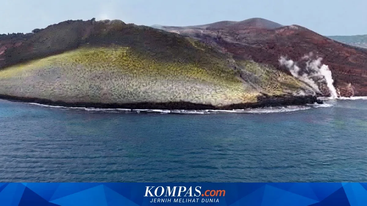
The appearance of new land in the waters between Mount Anak Krakatau and Sertung Island, in the Sunda Strait, has triggered public speculation about the birth of a new volcano nicknamed "Krakatau's grandchild". A member of the Indonesian Disaster Experts Association (IABI), Daryono, dismissed the notion. He stressed that the visible stretch of land is not an independent volcano, but rather the accumulation of volcanic material from Mount Anak Krakatau's eruptions that has settled on the seabed.
"In fact, this land is not an independent volcano, but an accumulation of volcanic material such as ash, rock, and lava from Mount Anak Krakatau's eruptions that has settled in the sea," Daryono said in a statement on Thursday (24/9/2026).
According to Daryono, the buildup of material has taken place gradually along with the volcano's increasing activity. The ever-accumulating sediment eventually emerged above the water's surface. This phenomenon is reinforced by the shallow seabed in the ancient caldera left by the 1883 eruption, which allows eruptive material to reach visible height more quickly.
Beyond the depth of the sea, the direction of ejected material also plays a major role. Daryono explained that pyroclastic ejecta and lava flows during eruptions have been predominantly thrown toward the southwest sector, precisely the area where the new land appeared. The dynamics of currents and waves in the Sunda Strait have also moved lighter sediment to calmer spots in the waters, allowing the material to settle permanently.
The head of the Mount Anak Krakatau Monitoring Post in Hargo Pancuran Village, Suwarno, confirmed the land's existence. He estimated the expanse that has emerged covers about 30.3 hectares. "Yes, that is the result of the recent eruption, its area is roughly 30.3 hectares. We are aware of the new land and it remains part of routine activity monitoring around the body of Mount Anak Krakatau and Sertung Island," Suwarno said.
Even so, Daryono cautioned that the land is not permanent. Its survival depends on the contest between the supply of new volcanic material and natural erosion. If Mount Anak Krakatau keeps erupting, the land will grow wider and more solid, especially if it is coated by molten lava that hardens into rock. Conversely, if eruptive activity subsides, wave action and sea abrasion could erode the loose sand deposits until they eventually sink again.
Another threat comes from the potential for underwater landslides or a major explosive eruption capable of destroying the young structure in a short time. This phenomenon shows how dynamic the volcanic landscape of the Sunda Strait is, a region that has historically served as a natural laboratory for disaster experts.
For Indonesia, the emergence of this land is not merely a geological wonder, but a reminder of the country's position on the Pacific Ring of Fire. Mount Anak Krakatau's rising activity demands that coastal communities in Lampung and Banten stay prepared for potential tsunamis and ashfall. In addition, the nature reserve around Krakatau remains closed to the public without a permit, so tourists and tourism businesses need to comply with the rule for everyone's safety.
Going forward, sustained monitoring will be key to understanding whether this land will endure or disappear into the sea. The question is, how prepared is disaster mitigation infrastructure around the Sunda Strait for volcanic dynamics that never truly subside?