Ninth Day of Search for Journalists in Sunda Strait: 22 Vessels Sweep Coastal Waters, Focus on Southeast of Anak Krakatau
Baca dalam 60 detik
- Basarnas membagi area pencarian KM Arupadatu I menjadi delapan sektor dengan total luas 3.439 NM persegi pada hari kesembilan.
- Jarak antar-lintas kapal dipersempit dari 3 NM menjadi 1–2 NM untuk meningkatkan ketelitian penyisiran di perairan pesisir.
- Aktivitas vulkanik Anak Krakatau dan cuaca menjadi pertimbangan utama keselamatan 570 personel yang dikerahkan.
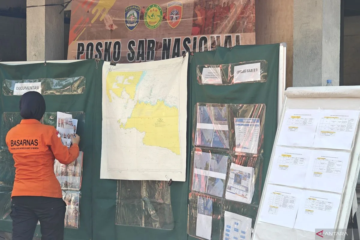
The search operation for the fast boat KM Arupadatu I, which was carrying a group of journalists in the Sunda Strait, entered its ninth day on Wednesday (16/9). The joint SAR team changed strategy by narrowing the search area to coastal waters and dividing it into eight sectors, after eight days in which the sweep had been concentrated farther out at sea.
The Head of the Operations Section at the Banten SAR Office, Rizky Dwianto, said the total area swept today reached 3,439 square nautical miles (NM). The significant change lay in the track spacing between vessels, narrowed from about 3 NM to 1–2 NM. "We tightened the track spacing so the sweep would be more detailed," he said at the Joint SAR Main Command Post, Carita Beach, Pandeglang.
The fleet deployment was focused on the southeastern area of Mount Anak Krakatau (GAK), based on calculations of current, wave, and wind movement from SARMAP modeling. A total of 570 personnel were deployed, consisting of 307 personnel in the main sea fleet and 263 personnel on standby at the land command post. They were supported by 22 sweeping vessels, including three KN SAR and two RIB vessels belonging to Basarnas, five KRI, two KAL, one RBB from the Indonesian Navy, and eight Polairud patrol boats.
The sector division covers areas from the open sea to near the coast. Sector A (511 NM) was swept by KRI Dewa Kembar and KP Sanjaya; Sector B (539 NM) by KN SAR Basudewa; Sector C (585 NM) by KRI Leuser; Sector D (319 NM) by KN SAR Antasena and KRI Lepu. Meanwhile, Sector E (271 NM) used RIB 02 Lampung and KAL Pahawang; Sector F (265 NM) by seven Polairud vessels; Sector G (282 NM) by RIB 02 Banten, KAL Anyer, and RBB Pulau Peucang; and Sector H (667 NM) escorted by KN SAR Tetuka, KRI Kerambit, KRI Gilimanuk, and KN Damaru.
Safety factors were a serious concern. BMKG forecast that the waters of the Sunda Strait would be cloudy with wave heights of 0.5–2.5 meters toward the northeast and wind speeds of 5–20 knots from the southeast to the south. Meanwhile, PVMBG reported that Mount Anak Krakatau remained covered in fog with shallow volcanic earthquake activity and continuous tremor. "The search continues to be guided by weather data and Anak Krakatau's activity, for the safety of personnel in the field," Rizky stressed.
"We tightened the track spacing so the sweep would be more detailed. The fleet's focus is southeast of Anak Krakatau, in line with current and wind modeling." — Rizky Dwianto, Head of the Operations Section at the Banten SAR Office
For readers in Indonesia, this operation is not merely a humanitarian mission. The Sunda Strait is a strategic shipping lane connecting Java and Sumatra, with dense traffic of passenger, logistics, and tourism vessels. The incident involving KM Arupadatu I—a fast boat carrying journalists—underscores the risks to maritime transport safety in waters known for strong currents and volcanic potential. Professionals in the logistics and tourism sectors need to watch how this SAR response affects confidence in shipping safety standards in the region.
Going forward, the duration of the operation will depend on weather conditions and the volcano's activity. If Anak Krakatau's tremor increases, the SAR team may have to adjust the sweep pattern again. The question is whether the monitoring infrastructure and evacuation protocols in the Sunda Strait are robust enough to anticipate similar incidents in the future.